Google Maps
An embedded map for an address or place.
On this page
The Google Maps widget embeds a map for an address, a place name or coordinates, with a zoom level, a map type and an adjustable height. It needs no API key. Maps load lazily, and with Load on click they load only when a visitor asks for them, which helps with privacy laws such as the GDPR.
Add a map
Insert it
Open Insert in the left panel, find Google Maps under Media (or type
mapin Search widgets) and click it or drag it onto the canvas.Enter the location
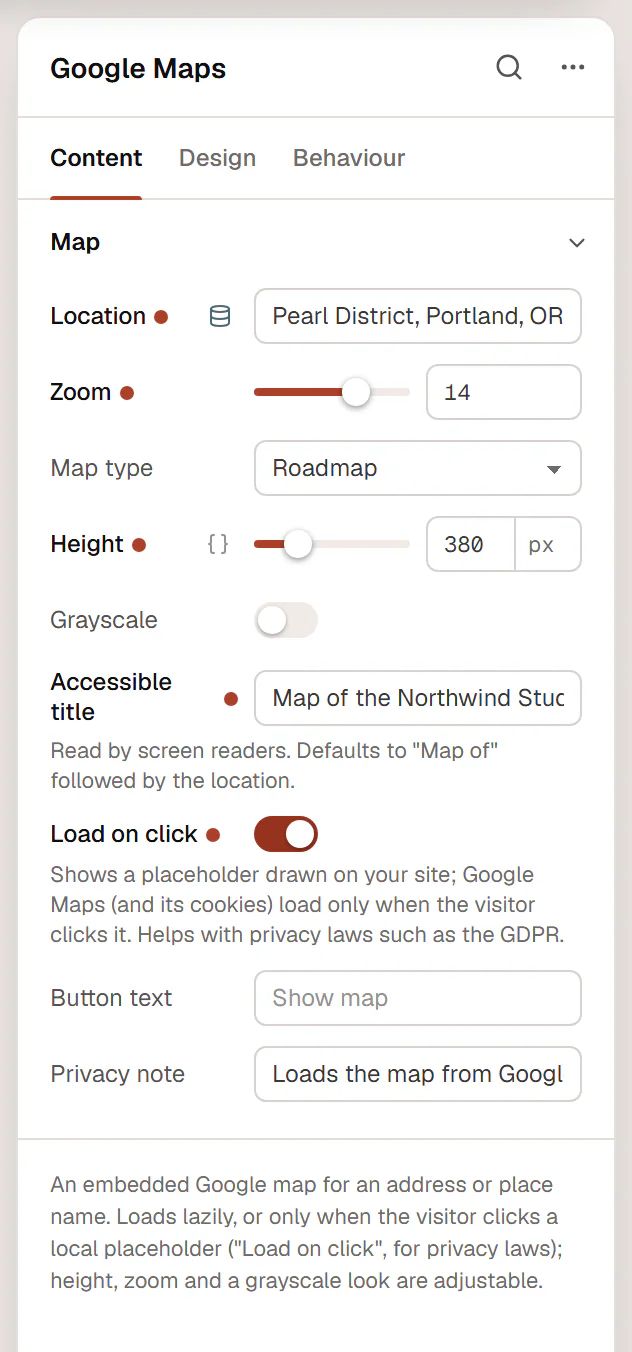
Type an address, a place name or coordinates in Location. The canvas shows the map.
Adjust the view
Set the Zoom, Map type and Height. Turn on Grayscale for a quieter map that matches a calm design.
Decide when it loads
Turn on Load on click to show a placeholder until the visitor clicks Show map.
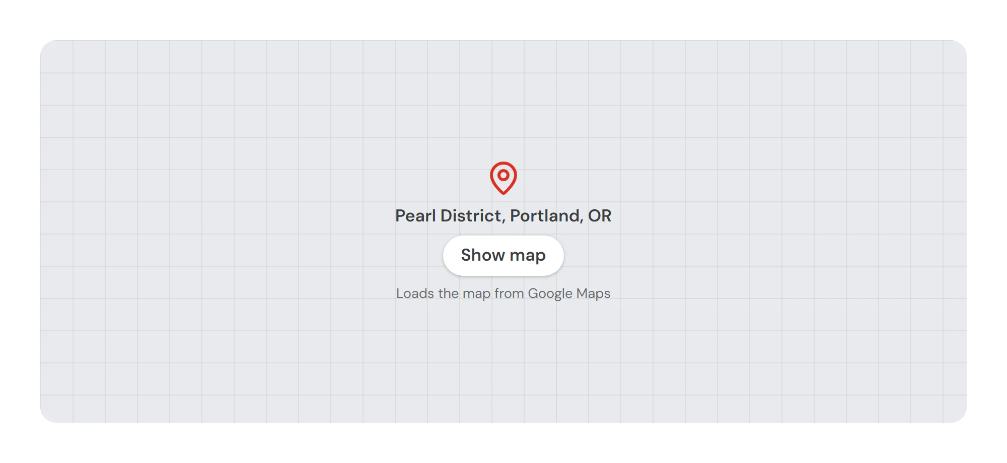
Load the map only on click
With Load on click on, visitors first see a placeholder drawn by your own site: a pin, the location, a button and a short privacy note. Nothing is requested from Google, and no Google cookies are set, until the visitor clicks. Then the real map loads in place. Change the button and the note with Button text and Privacy note.
In the editor you always see the real map, so you can check the location and zoom.
Settings
Settings marked Per device can differ on desktop, tablet and mobile (see Responsive editing). Location supports dynamic tags, for example an address from a custom field (see Dynamic tags).
Content tab
| Setting | What it does |
|---|---|
| Location | The place to show: an address, a place name or coordinates. Supports dynamic tags. |
| Zoom | How close the map is, from 1 (the whole world) to 20 (single buildings). Default: 14. |
| Map type | Roadmap, satellite, hybrid (satellite with labels) or terrain. Options: Roadmap, Satellite, Hybrid, Terrain. Default: Roadmap. |
| Height | Height of the map. Per device. |
| Grayscale | Shows the map in shades of gray, to blend with a calm design. |
| Color on hover | Brings the colors back when the pointer is over the map. Shown when Grayscale is on. |
| Accessible title | Name of the map for screen readers. Defaults to “Map of” followed by the location. |
| Load on click | Shows a placeholder drawn by your site with the location and a button; Google Maps (and its cookies) load only when the visitor clicks it. Helps with privacy laws such as the GDPR. The editor always shows the real map. |
| Button text | Text of the button on the placeholder. Leave empty for “Show map”. Shown when Load on click is on. |
| Privacy note | A short privacy note under the button. Shown when Load on click is on. |
Design tab
| Setting | What it does |
|---|---|
| Border radius | Rounds the corners of the map. Per device. |
| Border | Border of the map. |
| Shadow | Shadow of the map. |
| Normal › CSS filters | Blur, brightness, contrast, saturation and hue of the map. |
| Hover › CSS filters | Filters of the map on hover. |
| Hover › Transition (ms) | Duration of the hover change, in milliseconds. |
Every element also has these sections at the end of the Design tab.
| Section | What it does |
|---|---|
| Spacing & position | Margin, padding, width, alignment in its container, order, position (relative, absolute, fixed), offsets, z-index and global classes. See Spacing, size & position. |
| Background & border | Background, border, border radius, box shadow, overflow and opacity of the whole element. See Colors & backgrounds and Borders & shadows. |
| Mask | Crops the element to a shape (circle, arch, blob, star…) or your own SVG or PNG. See Shape dividers & masks. |
Behaviour tab
The Behaviour tab is the same for every element.
| Section | What it does |
|---|---|
| Anchor & classes | An Anchor ID for #links and your own CSS classes. |
| Animations | Entrance, scroll, hover and loop animations from presets or your own timeline. See Motion & effects. |
| Motion & effects | A simple entrance animation, transforms (also on hover), CSS and backdrop filters, and sticky positioning. |
| Scroll & mouse effects | Movement, rotation, scale, fade and blur while the page scrolls, and pointer effects (follow the pointer, 3D tilt). |
| Visibility | Hide the element on desktop, tablet or mobile, or in dark or light mode. See Visibility. |
| Conditions | Show the element only when rules match, such as logged-in visitors, a date range or a URL parameter. See Display conditions. |
| Interactions | Show, hide or change other elements when this one is clicked, hovered or scrolled into view. See Interactions. |
| Attributes | Custom HTML attributes for this element. See Anchor, classes & attributes. |
Tips
- Name the map. Screen readers announce the Accessible title. The default, “Map of” followed by the location, is fine; make it more specific if the page has several maps.
- Also write the address. Put the address in text next to the map too, for visitors who don't load the map and for search engines.
- Height on phones. A tall map fills a phone screen and gets in the way of scrolling; use a smaller Height on mobile.
- Privacy policy. Mention Google Maps in your privacy policy, especially without Load on click. See Cookie consent.